File:LumAllNeighborhoods.png
Jump to navigation
Jump to search
Size of this preview: 776 × 600 pixels. Other resolution: 1,056 × 816 pixels.
Original file (1,056 × 816 pixels, file size: 517 KB, MIME type: image/png)
Summary
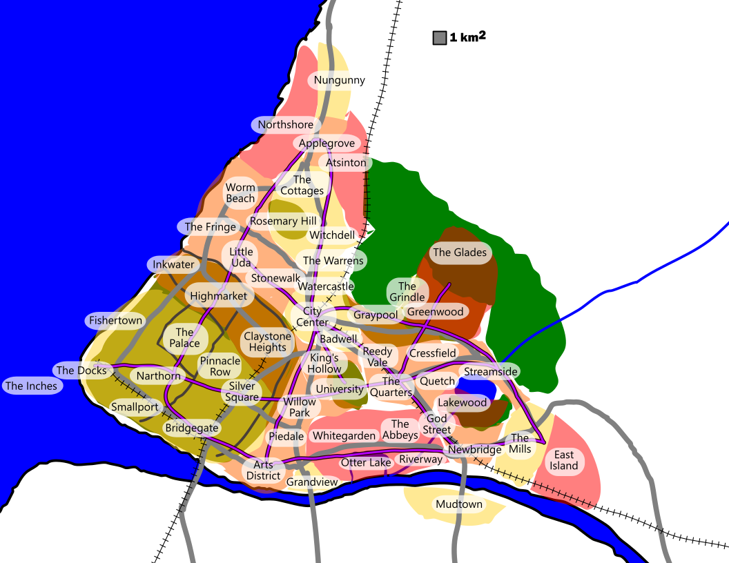
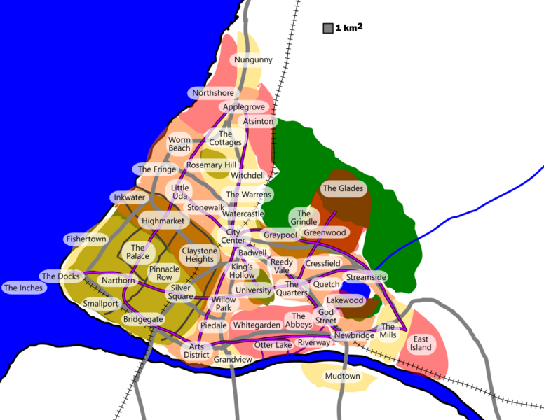
Rough map of the city of Lüm with fifty-two neighborhoods labeled. For use in the City '26 blog.
Licensing
File history
Click on a date/time to view the file as it appeared at that time.
| Date/Time | Thumbnail | Dimensions | User | Comment | |
|---|---|---|---|---|---|
| current | 16:05, 1 April 2026 | | 1,056 × 816 (517 KB) | Clé (talk | contribs) | Rough map of the city of Lüm with fifty-two neighborhoods labeled. For use in the City '26 blog. |
You cannot overwrite this file.
File usage
There are no pages that use this file.