File:ClaystoneHeightsX.png
Jump to navigation
Jump to search
Size of this preview: 776 × 600 pixels. Other resolution: 1,056 × 816 pixels.
Original file (1,056 × 816 pixels, file size: 462 KB, MIME type: image/png)
Summary
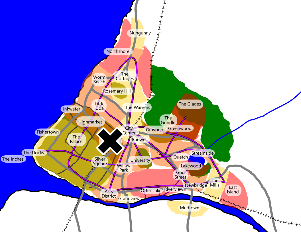
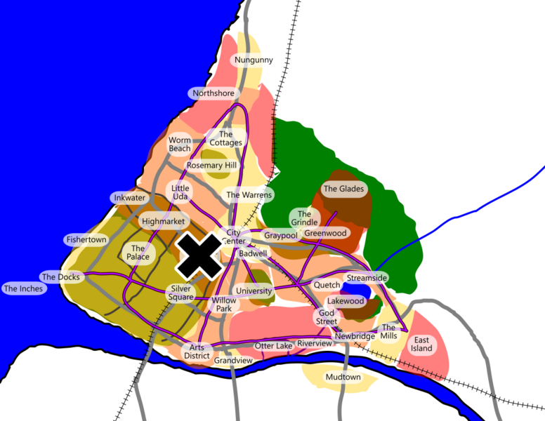
Rough map of the city of Lüm with a large X over the neighborhood of Claystone Heights (for use in the City '26 blog).
Licensing
File history
Click on a date/time to view the file as it appeared at that time.
| Date/Time | Thumbnail | Dimensions | User | Comment | |
|---|---|---|---|---|---|
| current | 15:36, 2 February 2026 | | 1,056 × 816 (462 KB) | Clé (talk | contribs) | Rough map of the city of Lüm with a large X over the neighborhood of Claystone Heights (for use in the City '26 blog). |
You cannot overwrite this file.
File usage
There are no pages that use this file.