File:FRAProvinces.png
Size of this preview: 706 × 600 pixels. Other resolutions: 2,410 × 2,048 pixels | 3,749 × 3,186 pixels.
Original file (3,749 × 3,186 pixels, file size: 1.55 MB, MIME type: image/png)
Summary
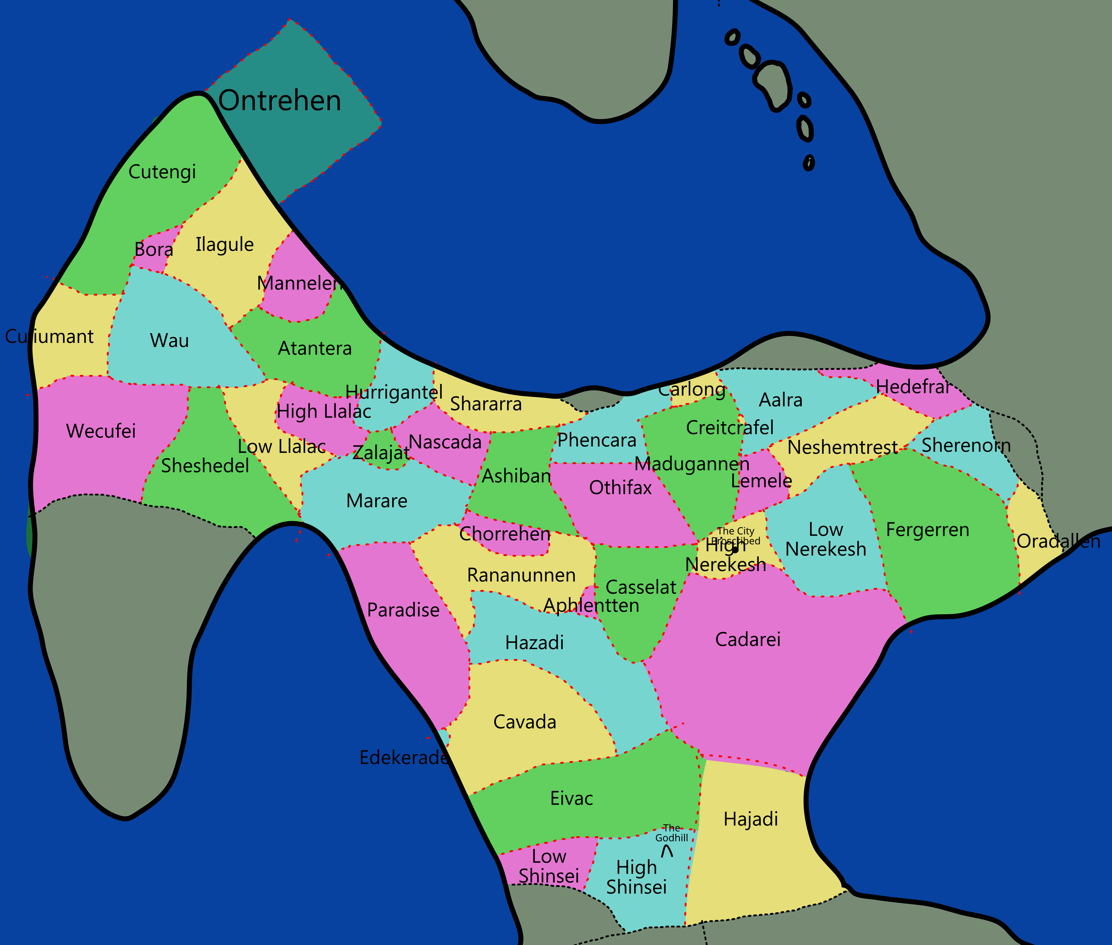
Rough map of the provinces of the Free Republic of Avelax (for use in a blog post)
Licensing
File history
Click on a date/time to view the file as it appeared at that time.
| Date/Time | Thumbnail | Dimensions | User | Comment | |
|---|---|---|---|---|---|
| current | 16:08, 13 January 2026 | | 3,749 × 3,186 (1.55 MB) | Clé (talk | contribs) | Rough map of the provinces of the Free Republic of Avelax (for use in a blog post) |
You cannot overwrite this file.
File usage
There are no pages that use this file.